
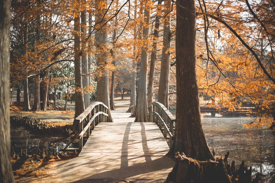
Park Rapids can look simple from a distance: a courthouse town, a trail town, a lake town. But the places people use every day tell a more useful story. Red Bridge Park is only one acre, yet it sits on Beach Road, connects by the red bridge to Heartland Park, and serves as a trailhead for the Heartland Trail. That makes it less like a pocket park and more like a hinge between the river, downtown, and the wider Heartland Lakes region.
A small park with a large job
The easiest mistake is to treat a place like Red Bridge Park as a scenic afterthought. In Park Rapids, it does real work. It is where the Fish Hook River corridor opens into public space, where trail users enter or leave the Heartland Trail, and where a short walk can turn into a longer outing. The city’s parks system names Red Bridge Park alongside larger civic spaces such as Deane Park, Depot Park, Lindquist Park, Pioneer Park, and Rice Park, but Red Bridge has a special role because it ties a river crossing to a regional trail connection.
That matters because Park Rapids is not built around a single big destination. It is built around links. The Heartland Trail starts in Park Rapids and extends to Cass Lake, and local trail materials describe it as a major regional route. In other words, the town is not merely near a trail; it is part of the trail’s origin story. A one-acre park that launches you into that system tells you a great deal about how the community sees movement, recreation, and access.
Park Rapids runs on connections, not isolation
That same pattern shows up beyond the riverbank. Hubbard County’s park system maintains public boat accesses and beaches at places such as Stony Lake, the Fish Hook River at Heartland Park, Garfield Lake near Laporte, and Paine Lake at Lake George Community Park. That spread of access points says something important: everyday recreation here is regional. People do not need to stay inside one city boundary to fish, swim, launch a boat, or spend an afternoon outside.
The same is true for mobility. Heartland Express says it provides curb-to-curb bus service to Park Rapids and Bemidji, can get riders around the City of Park Rapids, and works with county and human-service partners. That tells newcomers something practical: getting around here is possible, but it is not automatic. Park Rapids has transportation options, yet the region still asks people to think in terms of routes, schedules, and destination fit rather than assuming every errand is a short drive away.
Downtown is part of the same system
If the river park is one end of the story, downtown is the other. The chamber describes downtown Park Rapids as a place for shopping, festivals, food and beverage, and a historic main-street feel, and it highlights recurring programming such as the 2nd Street Stage. That helps explain why downtown is more than a business strip. It is a civic room where local identity is performed in public, especially during events that mix commerce, music, and casual gathering.
That downtown role fits the city’s history. Hubbard County was established in 1883, and Park Rapids was chosen as the county seat at the first meeting of county commissioners. The courthouse still stands as a prominent civic marker, and local documentary heritage is unusually strong: the Park Rapids Enterprise began publishing in 1882 and continues today. For a small city, that is a deep paper trail. It means Park Rapids has been telling itself who it is for a very long time.
Why the scale of the place matters
Park Rapids works the way it does because the surrounding county is large enough to create demand, but small enough that services have to be shared. The county’s population is just over 22,000, with an older age profile and a strong owner-occupied housing base. That combination supports schools, local government, and retail, but not every specialized service in one place. As a result, the practical geography of daily life includes nearby towns, townships, and regional facilities.
That is why it helps to think of Park Rapids alongside Akeley, Laporte, Nevis, and the rest of Hubbard County rather than pretending the city stands alone. The county emergency-management planning covers Park Rapids together with those neighboring municipalities, and the area’s trail, park, and road networks cross those lines constantly. A resident may live in one place, work in another, and recreate in a third without ever feeling unusual about it.
What a newcomer should notice first
If you are new to Park Rapids, the most revealing question is not “Where is the main street?” It is “How do people move between everyday places?” Once you ask that, the town becomes easier to understand. A child can use the school system and community education links. A rider can use Heartland Express. A family can go from downtown to the river park to the trail without treating those as separate worlds. And a weekend visitor can quickly see that the city’s public spaces are designed to connect rather than isolate.
That connective pattern also explains why Park Rapids feels bigger than its population suggests. The city has municipal water and sewer systems, an airport, parks, planning functions, and a courthouse-centered county government. Those are the bones of a place that works year-round, not just during lake season. The visible recreation pieces matter, but they sit on top of a deeper civic structure that keeps the town functioning when tourists are elsewhere and the weather is less forgiving.
The short version
Red Bridge Park is worth a stop because it shows Park Rapids in miniature. It links a river to a trail, a park to downtown life, and a local outing to a regional network. Once you notice that pattern, the rest of the community starts to make more sense: the county seat, the trail system, the bus service, the downtown events, and the nearby lakes all belong to the same working landscape.
If you want one simple way to understand Park Rapids better, start at the red bridge, follow the trail, and then walk back downtown. The route itself explains the town.