
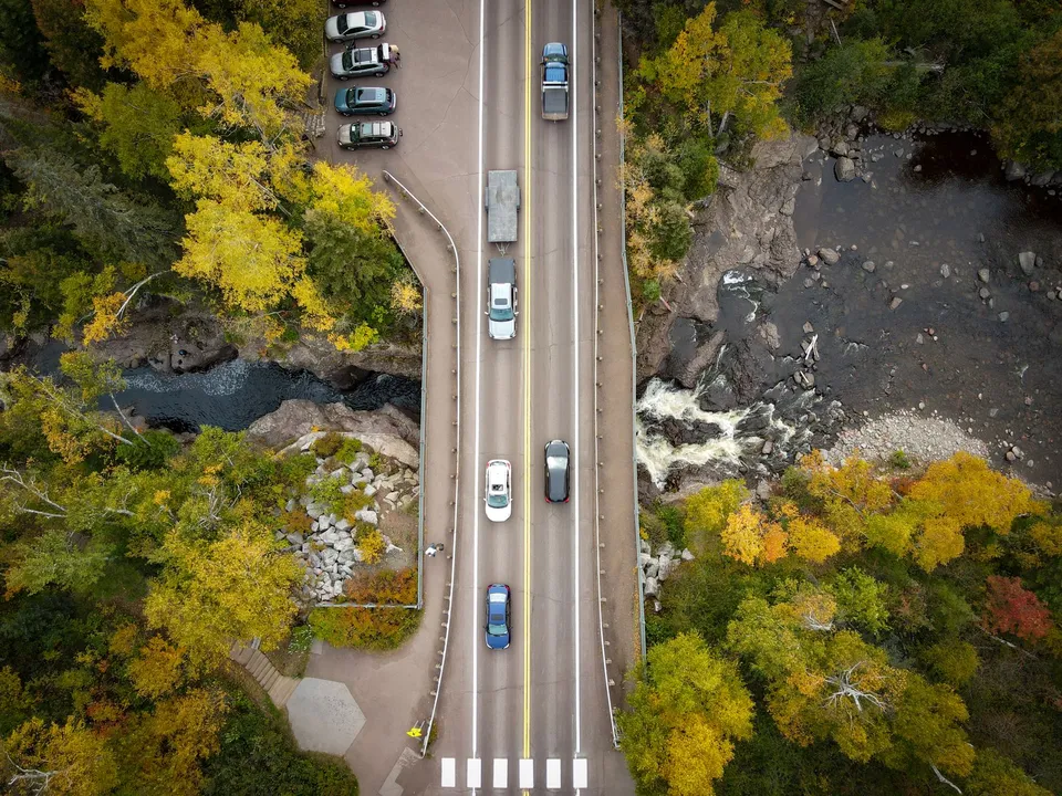
Park Rapids does not need a giant landmark to explain itself. One of the clearest clues is a park that covers just one acre. Red Bridge Park sits on Beach Road, connects by the red bridge to Heartland Park, and serves as a trailhead for the Heartland Trail. In a county-seat town that anchors a broad rural landscape, that small space does a lot of work: it links neighborhoods, river access, and regional recreation in a single stop.
A park that behaves like a connector
The Fish Hook River corridor is easy to think of as scenery, but Park Rapids uses it more like a piece of infrastructure. Red Bridge Park is not isolated from daily life; it is attached to Heartland Park, which puts it within a chain of public spaces rather than making it a destination unto itself. That matters because Park Rapids is not a dense city where every errand happens on one block. It is the county seat in a spread-out Hubbard County, so useful places tend to be places that help people move between purposes: walking, fishing, gathering, and getting onto the trail.
Downtown tells the same story in a different way. The Chamber promotes a historic main-street feel, downtown shopping, food and beverage options, festivals, and recurring programming such as the 2nd Street Stage. In other words, the center of town is not only a retail strip; it is also where civic life and event life overlap. That is why Park Rapids feels bigger than a map pin. It keeps gathering spaces close together without making them identical.
The trail explains the scale of the town
The Heartland Trail is the reason Red Bridge Park matters beyond the neighborhood around it. County planning material says the trail starts in Park Rapids and extends to Cass Lake, and the chamber describes it as a 100-plus-mile system. That gives the town a role that many small communities do not have: Park Rapids is not just a place people pass through on the way to recreation elsewhere. It is a node in a larger trail network.
That regional role reaches beyond one trail, too. Hubbard County maintains public boat accesses and beaches at places including Stony Lake, the Fish Hook River at Heartland Park, Garfield Lake near Laporte, and Paine Lake at Lake George Community Park. Taken together, those sites show that recreation in this area is distributed across the county, with Park Rapids acting as one anchor among several, not the only hub. For visitors and residents alike, that means the local map is best understood as a set of connected access points rather than one central park or one central lake.
Park Rapids runs on shared systems
The town also reveals itself through its services. The city website routes residents to KRLS rather than presenting the library as a city department, and it links to community education and school information. That is a small but telling detail: learning in Park Rapids is not locked inside one building or one agency. It is shared regionally, the way many essential services are in a small county seat.
Transportation follows the same pattern. Heartland Express says it provides curb-to-curb bus service to Park Rapids and Bemidji and can get riders around the City of Park Rapids. It also says it works with veterans services, community education, the Development Achievement Center, social services, and Medicaid. That tells you something practical about life here: mobility is part of access. A town can have schools, parks, and services on paper, but if people cannot reliably reach them, the system breaks down. Park Rapids has built part of that connection through county transit.
The civic buildings matter, too
Another clue sits just off the recreational map. The Park Rapids Municipal Airport has 44 T-hangars available for rent and a second-floor terminal meeting room that can be rented for a full day or half day. That is not a grand airport complex, but it is more than a runway. It is a small civic facility that supports flying, meetings, and local utility in one place. In a region where distance matters, that kind of multi-use infrastructure makes the town more functional than its size suggests.
The same is true of water and sewer. Park Rapids reports 1,370 municipal water connections, 1,270 sewer connections, two water towers, five wells, and 16 lift stations. Those numbers are easy to overlook, but they explain why the city can support year-round homes, public buildings, and business activity while many surrounding properties are spread across lakes and townships. A park, a trail, an airport, and a utility system may not sound related at first. In Park Rapids, they are all parts of the same settlement pattern.
If you want to understand Park Rapids without flattening it, start with the red bridge, then follow the river, and then notice how quickly you reach the trail, downtown, and the city systems behind them. A good next step is simple: walk the bridge, then look at how the Heartland Trail and downtown park network meet in the center of town.